|
Photo Gallery: click on any photo
|
Route Map
|
|
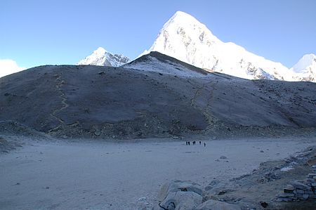 |
Viewing Point:
Really modest is the impression of our little hill Kala Pattar (5545m)
in front of a proper mountain, Pumo Ri rising to 7165m. |
|
 |
Icing Sugar:
Late the day before and during the night it had been snowing. By the
morning sun's warmth it melted quickly.
|
|
 |
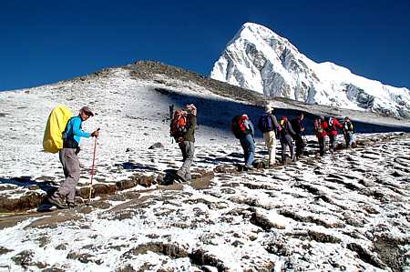
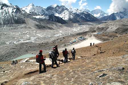
Easily:
There are easy gradients in between, but most time it is a steep
ascent. The walk is somewhat limited with a height difference of only
400m to overcome but you will soon recognise that you are moving at a
level of more than 5000m.
With a little spurt after stopping for photographs I immediately got
out of breath.
It took us 1.75 hours from the lodge to the summit. |
|
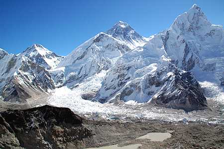 |
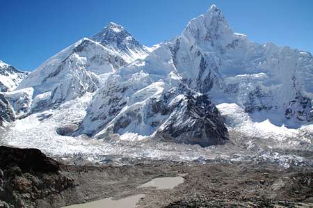
There it is:
To take in this view we have been travelling around the world. Right in
the centre of the picture is the top of the world's highest mountain, Mount
Everest, to the right Nuptse (7864m). Clearly visible is Khumbu glacier
as it bends down and to the South. |
|
 |
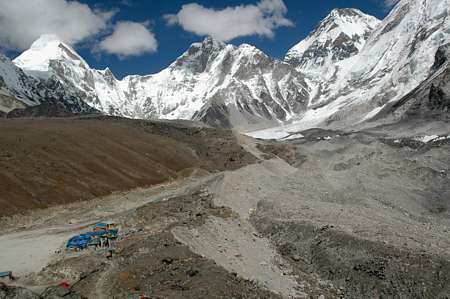
Pumori Base Camp:
Cut out of the previous photo the tents of Pumori Base Camp can be
spotted. At this time two expeditions were present, a German and an
Italian one.
The German group already had health problems when a tragic accident hit
the Italian group. Four sherpas lost their lives in an avalanche on
14/10/06.
Certainly both expeditions were abandoned.
Link:
everestnews.com
|
|
 |
The View:
The view from the top of Kala Pattar is remarkable in every direction.
This is Southwest. |
|
 |
Once again, it's
too beautiful:
The view to Everest with Nuptse. |
|
 |
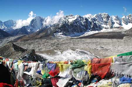
Mountain Arena:
To the left the Khumbu glacier is on its way of 10 kilometers to the
South. |
|
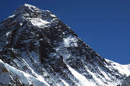 |
The Mountain
itself:
Its Tibetian name is "Chomolungma", meaning "God's
mother of the country".
1865 the mountain was called after the British surveyor Sir George
Everest.
1960 the Nepalese government announced a Nepalese name: Sagarmatha (God
of the sky).
The photo shows the South East ridge with South Col to the right. |
|
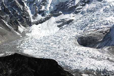 |
Ice Fall:
The zoom is too short to show the tents of Everest Base Camp which are
placed to the left of Khumbu glacier. In the enlarged photo some yellow
and blue spots can be found. |
|
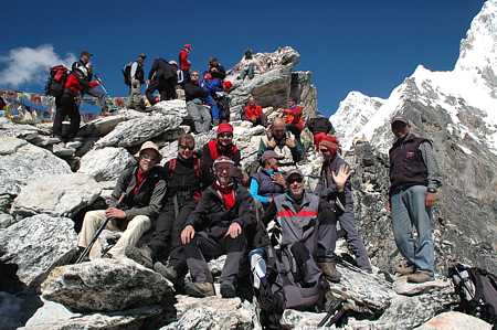 |
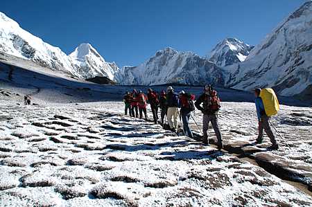
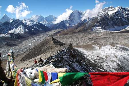
Populated:
Kala Pattar is the most popular trekking peak in the Everest area.
One has to queue for the best viewing places. |
|
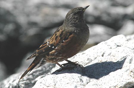 |
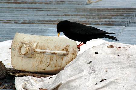
Mountain Bird:
Even small songbirds make their way up to 5545m, right to the top of
Kala Pattar. |
|
 |
Descent:
It takes us about one
hour to get down to the lodge of Gorak Shep. |
|
 |
Luxury is relative:
The entry in my diary
describes the lodge as: "cold, dark, smelly." |
|
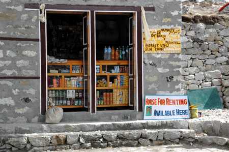 |
Shop:
All you need is available, and if your legs are tired you may rent a
horse. |
|
 |
Well Known Birds:
Alpine daws behave in the same manner in the Himalaya and around the
Matterhorn. |
|
 |
Good Bye:
We are leaving Gorak Shep and have a last look back to Khumbu valley. |
|
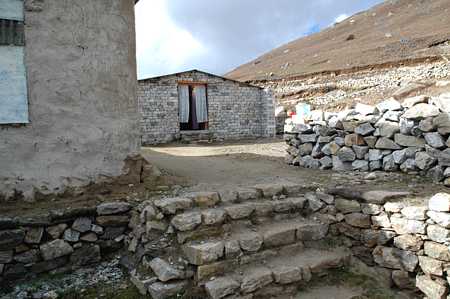 |
Alpine Inn:
Our lodge in Lobuche has not yet reached the Apline standard. |
|
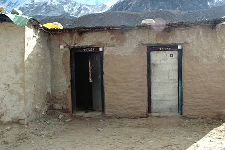 |
Facilities:
Toilets basically vary between two kinds: The ones with a hole which is
so big that you are afraid to fall in and the onew with a hole which is
so small that your predecessor had problems to hit it. |
|
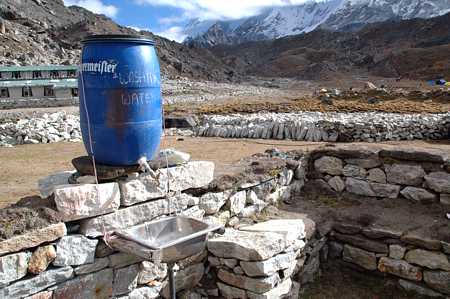 |
Bathroom:
Washing water is provided outside. If you prefer hot water, it is
available on request. |
|
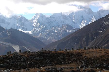 |
Memorials:
High on the pass at 4800m before descending to Duglha. |
|
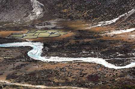 |
Green Acres:
At the hamlet of Phulung Kharka (4300m) every plain square meter is
used for planting. |
|
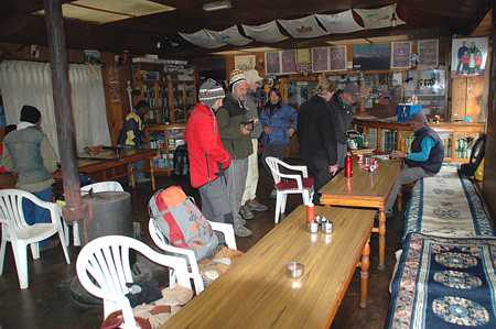 |
Cosy:
The lounge of the Snow Lion Lodge in Dingboche invites the trekkers to
feel at home.
We are staying overnight here, before moving on and up again to Chukhung.
> next
page |